
FloodCast
Measured first, modelled second.
FloodCast watches India's rivers and the glacial lakes of the Hindu Kush Himalaya, continuously and unattended. It serves what gauges and satellites measure the moment it arrives, and releases modelled layers only when they beat a persistence baseline.
Request a briefing
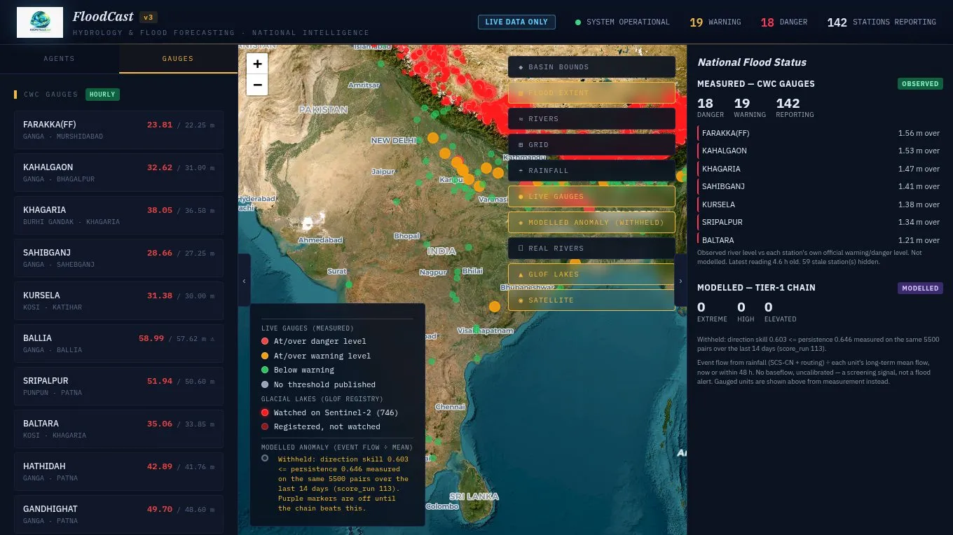
The gauge decides the colour
An alert is derived from the measurement alone: over the warning mark is warning, over the danger mark is danger. No model sits between the gauge and the map.
Lakes watched directly
A glacial lake outburst has no pathway in a rainfall model, so FloodCast watches the lakes on satellite imagery and watches the ground for quakes and landslides.
Models earn their release
The rainfall-to-runoff chain is scored every morning against the gauges and against persistence on identical pairs, and reaches the map only when it clears that bar.
What it does
- About 200 Central Water Commission river stations, observed hourly as shipped, 13 Sep 2026
- 3,553 registered glacial lakes, 746 measured daily on Sentinel-2 as shipped, 13 Sep 2026
- USGS seismic feed polled every five minutes for outburst triggers
- Rainfall analysis and forecast on 11,532 grid points, none interpolated as shipped, 13 Sep 2026
- Rainfall-to-runoff chain over 6,494 sub-basins, three times a day modelled, released as it clears its bar
- A 07:30 IST digest of stations at warning or danger and new crossings
Every API response carries a basis field, observed or modelled. Nothing synthetic is served.
Who it is for
- State and national disaster management authorities
- Water resources engineers and reservoir operators
- Insurers and researchers
How it starts
Briefing
Your basins, lakes and alert thresholds walked through on the live map.
Access
Credentialed accounts per organisation, with the daily digest.
Extend
Your own gauges and reservoirs added as observed layers.
Request a briefing
Write to us and we will set up a walkthrough of FloodCast on live data.
Email info@aionpl.com